Lupton, Michigan | |
|---|---|
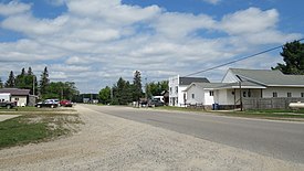
 Looking north along Main Street | |
 Location within Ogemaw County | |
| Coordinates: 44°25′52″N 84°01′33″W / 44.43111°N 84.02583°W | |
| Country | United States |
| State | Michigan |
| County | Ogemaw |
| Townships | Cumming and Rose |
| Settled | 1880 |
| Area | |
| • Total | 3.26 sq mi (8.45 km2) |
| • Land | 3.23 sq mi (8.37 km2) |
| • Water | 0.03 sq mi (0.08 km2) |
| Elevation | 922 ft (281 m) |
| Population (2020) | |
| • Total | 318 |
| • Density | 98.39/sq mi (37.99/km2) |
| Time zone | UTC-5 (Eastern (EST)) |
| • Summer (DST) | UTC-4 (EDT) |
| ZIP code(s) | 48635 |
| Area code | 989 |
| GNIS feature ID | 1620647[2] |
Lupton is an unincorporated community and census-designated place (CDP) in Ogemaw County in the U.S. state of Michigan. The population of the CDP was 318 at the 2020 census. Lupton is located mostly within Rose Township with a small portion extending south into Cumming Township.[3]
- ^ "2020 U.S. Gazetteer Files". United States Census Bureau. Retrieved May 21, 2022.
- ^ "Lupton". Geographic Names Information System. United States Geological Survey, United States Department of the Interior.
- ^ "Michigan: 2010 Population and Housing Unit Counts 2010 Census of Population and Housing" (PDF). 2010 United States Census. United States Census Bureau. September 2012. pp. 37–38 Michigan. Retrieved August 17, 2021.

