Luquillo
Municipio de Luquillo | |
|---|---|
Town and Municipality | |
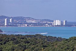
 High rise buildings in Luquillo. | |
| Nicknames: "Capital del Sol", "La Riviera de Puerto Rico", "Los Come Cocos" | |
| Anthem: "Junto a las costas del mar Atlántico" | |
 Map of Puerto Rico highlighting Luquillo Municipality | |
| Coordinates: 18°22′21″N 65°43′00″W / 18.37250°N 65.71667°W | |
| Sovereign state | |
| Commonwealth | |
| Settled | 1719 |
| Founded | October 26, 1797 |
| Barrios | |
| Government | |
| • Mayor | Jesús Márquez Rodríguez (PPD) |
| • Senatorial dist. | 8 - Carolina |
| • Representative dist. | 36 |
| Area | |
| • Total | 34.26 sq mi (88.73 km2) |
| • Land | 26 sq mi (68 km2) |
| • Water | 8.00 sq mi (20.73 km2) |
| Population (2020)[1] | |
| • Total | 17,781 |
| • Rank | 64th in Puerto Rico |
| • Density | 520/sq mi (200/km2) |
| Demonym | Luquillenses or Luquillanos |
| Time zone | UTC−4 (AST) |
| ZIP Code | 00773 |
| Area code | 787/939 |
| Major routes | |
Luquillo (Spanish pronunciation: [luˈkiʎo]) is a town and municipality of Puerto Rico located in the northeast coast, northwest of Fajardo; and east of Rio Grande. Luquillo is spread over 5 barrios and Luquillo Pueblo (the downtown area and the administrative center of the city). It lends its name to the Sierra de Luquillo, where El Yunque National Forest is located. It is part of the Fajardo Metropolitan Statistical Area.
The city of Luquillo is 26 square miles and it sits on 12 miles of Atlantic coastline. It is nestled between the blue waters of the Atlantic and the El Yunque National Forest, a rainforest, giving it a diverse and unique ecology. Luquillo marks the beginning of the Northeast Ecological Corridor Nature Reserve which runs down the coast from downtown Luquillo all the way down to the Seven Seas Beach in Fajardo. During certain times of the year, it is not unusual to encounter rare or endangered species of fauna (like the leatherback turtle) while visiting in Luquillo.[2]
- ^ Bureau, US Census. "PUERTO RICO: 2020 Census". The United States Census Bureau. Retrieved August 25, 2021.
{{cite web}}:|last=has generic name (help) - ^ "Luquillo PR 2015: Everything You Need To Know About Luquillo". Archived from the original on October 19, 2018. Retrieved December 28, 2018.

