| Commuter rail & Intercity rail | |||||||
 Lurgan Station in its current 1970s look. | |||||||
| General information | |||||||
| Location | Lurgan County Armagh Northern Ireland | ||||||
| Coordinates | 54°28′01″N 6°20′17″W / 54.467°N 6.338°W | ||||||
| Owned by | NI Railways LTD[1] | ||||||
| Operated by | Translink (Northern Ireland) | ||||||
| Line(s) | DublinPortadown/Newry | ||||||
| Platforms | 2 | ||||||
| Tracks | 2 | ||||||
| Train operators | NI Railways, Iarnród Éireann | ||||||
| Bus routes | Ulsterbus Town Services / 352[2] | ||||||
| Bus stands | 1 | ||||||
| Bus operators | Ulsterbus | ||||||
| Construction | |||||||
| Structure type | At-grade | ||||||
| Parking | 124 spaces[3] | ||||||
| Bicycle facilities | Spaces Available | ||||||
| Accessible | Step free access? - Yes, via level crossing | ||||||
| Architect | William H. Mills | ||||||
| Other information | |||||||
| Status | Operational | ||||||
| Station code | LURGN | ||||||
| Fare zone | 3[4] | ||||||
| Website | translink | ||||||
| History | |||||||
| Electrified | Never | ||||||
| Previous names | Craigavon East - Lurgan | ||||||
| Original company | Ulster Railway | ||||||
| Post-grouping | Great Northern Railway (Ireland) | ||||||
| Key dates | |||||||
| 1841 | Station opened | ||||||
| 1890s | Station Rebuilt[5] | ||||||
| 1972 | Original Station Building Destroyed in Bomb attack. | ||||||
| 2024-2025 | The 1970's Station planned to be redeveloped. | ||||||
| Passengers | |||||||
| 2015/16 | 784,630 [6] | ||||||
| 2016/17 | |||||||
| 2017/18 | |||||||
| 2018/19 | |||||||
| 2019/20 | |||||||
| 2020/21 | |||||||
| 2021/22 | |||||||
| 2022/23 | |||||||
| 2023/24 | |||||||
| |||||||
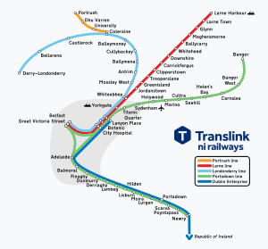
Lurgan railway station serves Lurgan in County Armagh, Northern Ireland. Located on William Street. The station is managed by NI Railways. With just under 867,000 passengers boarding or alighting at the station in the year 2023/24 financial year, Lurgan is the 9th-busiest station on the NIR network.[12]
- ^ Rooney, Dónal (17 June 2024). "Information about ownership". whatdotheyknow.co.uk. Northern Ireland Transport Holding Company. Archived from the original on 18 July 2024. Retrieved 18 July 2024.
- ^ "Lurgan Town Service". Translink. Retrieved 2 January 2024.
- ^ "Lurgan Train Station". parkopedia.co.uk. Retrieved 2 January 2024.
- ^ "iLink Zone information". translink.co.uk. Translink. Archived from the original on 8 November 2023. Retrieved 1 November 2023.
- ^ "1897- Railway Station, Lurgan, Co. Armagh". Archiseek. April 2014. Archived from the original on 7 July 2024. Retrieved 28 December 2023.
- ^ a b c "NIR Footfall 1518.xlsx". www.whatdotheyknow.com. 20 December 2018. Archived from the original on 17 June 2024. Retrieved 17 June 2024.
- ^ "NIR Footfall 1819.xlsx". www.whatdotheyknow.com. 15 January 2020. Archived from the original on 17 June 2024. Retrieved 17 June 2024.
- ^ "NIR Footfall 1920.xlsx". www.whatdotheyknow.com. 11 August 2020. Archived from the original on 17 June 2024. Retrieved 17 June 2024.
- ^ "FOI1317 NIR Footfall 2021.xlsx". www.whatdotheyknow.com. 25 February 2021. Archived from the original on 17 June 2024. Retrieved 17 June 2024.
- ^ "FOI1317 NIR Footfall 2122.xlsx". www.whatdotheyknow.com. 26 April 2022. Archived from the original on 17 June 2024. Retrieved 17 June 2024.
- ^ "FOI1317 NIR Footfall 2223.xlsx". www.whatdotheyknow.com. 17 April 2023. Archived from the original on 31 October 2023. Retrieved 16 October 2023.
- ^ a b "FOI Footfall 2023 2024 figures PDF.pdf". www.whatdotheyknow.com. 7 May 2024. Archived from the original on 7 July 2024. Retrieved 30 May 2024.


