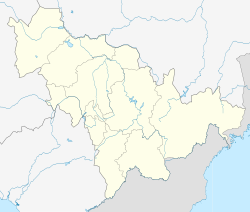
Luyuan
绿园区 | |||||||||||||||||||||||||||||||||
|---|---|---|---|---|---|---|---|---|---|---|---|---|---|---|---|---|---|---|---|---|---|---|---|---|---|---|---|---|---|---|---|---|---|
 | |||||||||||||||||||||||||||||||||
| Coordinates: 43°52′46″N 125°16′19″E / 43.8795°N 125.2720°E[1] | |||||||||||||||||||||||||||||||||
| Country | People's Republic of China | ||||||||||||||||||||||||||||||||
| Province | Jilin | ||||||||||||||||||||||||||||||||
| Sub-provincial city | Changchun | ||||||||||||||||||||||||||||||||
| Area | |||||||||||||||||||||||||||||||||
• Total | 338 km2 (131 sq mi) | ||||||||||||||||||||||||||||||||
| Population (2010)[3] | |||||||||||||||||||||||||||||||||
• Total | 810,551 | ||||||||||||||||||||||||||||||||
| • Density | 2,400/km2 (6,200/sq mi) | ||||||||||||||||||||||||||||||||
| Time zone | UTC+8 (China Standard) | ||||||||||||||||||||||||||||||||
| Postal code | 130062 | ||||||||||||||||||||||||||||||||
| Changchun district map |
| ||||||||||||||||||||||||||||||||
| Website | luyuan | ||||||||||||||||||||||||||||||||
Luyuan District (Chinese: 绿园区; pinyin: Lùyuán Qū[a]) is one of seven districts of the prefecture-level city of Changchun, the capital of Jilin Province, Northeast China, forming part of the city's urban core. It borders Kuancheng District to the north and east, Chaoyang District to the south, and Nong'an County to the north and west, as well as the prefecture-level city of Siping to the west.
- ^ "Luyuan" (Map). Google Maps. Retrieved 2014-07-02.
- ^ Changchun Statistical Yearbook 2011 (《长春统计年鉴2011》). Accessed 8 July 2014.
- ^ 2010 Census county-by-county statistics (《中国2010年人口普查分县资料》). Accessed 8 July 2014.
Cite error: There are <ref group=lower-alpha> tags or {{efn}} templates on this page, but the references will not show without a {{reflist|group=lower-alpha}} template or {{notelist}} template (see the help page).

