Lynfield | |
|---|---|
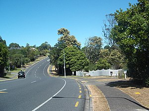
 Halsey Drive in Lynfield | |
 | |
| Coordinates: 36°55′38″S 174°43′21″E / 36.927109°S 174.722412°E | |
| Country | New Zealand |
| City | Auckland |
| Local authority | Auckland Council |
| Electoral ward | Albert-Eden-Puketāpapa ward |
| Local board | Puketāpapa Local Board |
| Area | |
| • Land | 252 ha (623 acres) |
| Population (June 2024)[2] | |
• Total | 9,130 |
| New Windsor | Mount Roskill | Mount Roskill |
| Blockhouse Bay |
|
Waikōwhai |
| (Manukau Harbour) | (Manukau Harbour) | (Manukau Harbour) |
Lynfield is a suburb of Auckland, New Zealand. It is under the local governance of Auckland Council. The suburb is located on the southwestern Auckland isthmus bordering the Manukau Harbour, much of which is densely forested with native forest. Lynfield was developed for suburban housing in the late 1950s and 1960s, modelled after American-style suburbs.
- ^ Cite error: The named reference
Areawas invoked but never defined (see the help page). - ^ "Aotearoa Data Explorer". Statistics New Zealand. Retrieved 26 October 2024.