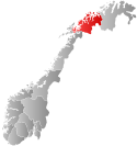
Lyngen Municipality
Lyngen kommune | |
|---|---|
 The peninsula as seen by Sentinel-2 | |
 Troms within Norway | |
 Lyngen within Troms | |
| Coordinates: 69°41′25″N 20°04′54″E / 69.69028°N 20.08167°E | |
| Country | Norway |
| County | Troms |
| District | Nord-Troms |
| Established | 1 Jan 1838 |
| • Created as | Formannskapsdistrikt |
| Administrative centre | Lyngseidet |
| Government | |
| • Mayor (2023) | Eirik Larsen (Local list) |
| Area | |
• Total | 812.70 km2 (313.79 sq mi) |
| • Land | 795.12 km2 (307.00 sq mi) |
| • Water | 17.58 km2 (6.79 sq mi) 2.2% |
| • Rank | #141 in Norway |
| Highest elevation | 1,834 m (6,017 ft) |
| Population (2024) | |
• Total | 2,743 |
| • Rank | #242 in Norway |
| • Density | 3.4/km2 (9/sq mi) |
| • Change (10 years) | |
| Demonym | Lyngsfjerding[2] |
| Official language | |
| • Norwegian form | Neutral |
| Time zone | UTC+01:00 (CET) |
| • Summer (DST) | UTC+02:00 (CEST) |
| ISO 3166 code | NO-5536[4] |
| Website | Official website |
Lyngen (Northern Sami: Ivgu; Kven: Yykeä[5]) is a municipality in Troms county, Norway. The administrative centre of the municipality is the village of Lyngseidet. Other notable villages include Furuflaten, Lattervika, Nord-Lenangen, and Svensby.
The 813-square-kilometre (314 sq mi) municipality is the 141st largest by area out of the 357 municipalities in Norway. Lyngen is the 242nd most populous municipality in Norway with a population of 2,743. The municipality's population density is 3.4 inhabitants per square kilometre (8.8/sq mi) and its population has decreased by 8.3% over the previous 10-year period.[6][7]
- ^ "Høgaste fjelltopp i kvar kommune" (in Norwegian). Kartverket. 16 January 2024.
- ^ "Navn på steder og personer: Innbyggjarnamn" (in Norwegian). Språkrådet.
- ^ "Forskrift om målvedtak i kommunar og fylkeskommunar" (in Norwegian). Lovdata.no.
- ^ Bolstad, Erik; Thorsnæs, Geir, eds. (26 January 2023). "Kommunenummer". Store norske leksikon (in Norwegian). Kunnskapsforlaget.
- ^ "Informasjon om stadnamn". Norgeskart (in Norwegian). Kartverket. Retrieved 9 July 2024.
- ^ Statistisk sentralbyrå. "Table: 06913: Population 1 January and population changes during the calendar year (M)" (in Norwegian).
- ^ Statistisk sentralbyrå. "09280: Area of land and fresh water (km²) (M)" (in Norwegian).

