Mabbettsville, New York | |
|---|---|
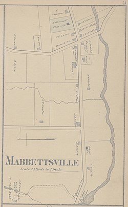
 map from the New illustrated atlas of Dutchess County, New York, published by H.L. Kochersperger in 1876 | |
| Coordinates: 41°47′33″N 73°39′34″W / 41.79250°N 73.65944°W | |
| Country | United States |
| State | New York |
| County | Dutchess |
| Town | Washington |
| Named for | James Mabbett |
| Elevation | 696 ft (212 m) |
| Time zone | UTC-5 (Eastern (EST)) |
| • Summer (DST) | UTC-5 (EST) |
| Former name | Flikentown |
Mabbettsville is a settlement in Dutchess County, New York, United States.[1] Located 2 miles (3 km) east of Millbrook in the town of Washington on U.S. Route 44,[2] it is approximately 85 miles (137 km) north of New York City.
The settlement forms one of the most concentrated residential areas of the town,[3] and is the location of Town Park,[4] a baseball field – one of the few recreational areas to the east of Washington.[3] The settlement's main commerce is related to recreation, including dog kennels, antique shops, and a range of home and landscape occupations.[3]
- ^ "Mabbettsville, New York, Community Profile". HomeTownLocator. HTL, Inc. Retrieved March 7, 2010.
- ^ "Town of Washington Cemeteries". Rootsweb. Ancestry.com. February 6, 2001. Retrieved March 7, 2010.
- ^ a b c "Distribution of Land Use" (PDF). Land Use and Land Management. Washington Town Board. June 12, 2009. Archived from the original (PDF) on July 28, 2011. Retrieved March 7, 2010.
- ^ "Town Seeks Concession Stand Vendor". Town of Washington News. Washington Town Board. March 5, 2010. Retrieved March 7, 2010.
