Macamic | |
|---|---|
 | |
| Motto(s): Vois juste, probité engendre honneur ("Do right, integrity begets honour") | |
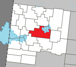
 Location within Abitibi-Ouest RCM | |
| Coordinates: 48°45′N 79°00′W / 48.750°N 79.000°W[1] | |
| Country | Canada |
| Province | Quebec |
| Region | Abitibi-Témiscamingue |
| RCM | Abitibi-Ouest |
| Settled | 1913 |
| Constituted | March 6, 2002 |
| Government | |
| • Mayor | Tony Boudreau |
| • Federal riding | Abitibi—Témiscamingue |
| • Prov. riding | Abitibi-Ouest |
| Area | |
• Total | 240.62 km2 (92.90 sq mi) |
| • Land | 202.05 km2 (78.01 sq mi) |
| • Urban | 2.00 km2 (0.77 sq mi) |
| Population (2021)[3] | |
• Total | 2,744 |
| • Density | 13.5/km2 (35/sq mi) |
| • Urban | 1,352 |
| • Urban density | 676.0/km2 (1,751/sq mi) |
| • Pop (2016-2021) | |
| • Dwellings | 1,188 |
| Time zone | UTC−5 (EST) |
| • Summer (DST) | UTC−4 (EDT) |
| Postal code(s) | |
| Area code | 819 |
| Highways | |
| Website | www |

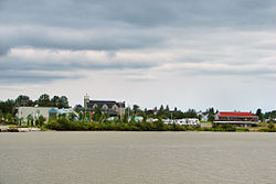
Macamic is a ville in northwestern Quebec, Canada, in the Abitibi-Ouest Regional County Municipality. It covers 202 km² and had a population of 2,744 in the 2021 Canadian census. It is located on the shores of the namesake Lake Macamic.
In addition to Macamic itself, the town's territory also includes the community of Colombourg.
- ^ Cite error: The named reference
toponymiewas invoked but never defined (see the help page). - ^ a b "Macamic". Répertoire des municipalités (in French). Ministère des Affaires municipales et de l'Habitation. Retrieved 2023-06-29.
- ^ a b "Macamic (Code 2487058) Census Profile". 2021 census. Government of Canada - Statistics Canada.
- ^ a b "Macamic Quebec [Population centre] Census Profile, 2021 Census of Population". www12.statcan.gc.ca. Government of Canada - Statistics Canada. 9 February 2022. Retrieved 29 June 2023.
