This article needs additional citations for verification. (April 2024) |
Madhubani
Modhubanni | |
|---|---|
City | |
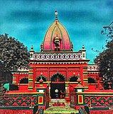
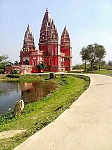
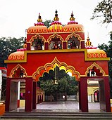
Clockwise from top: Madhubani City skyline, Madhubani railway station ,Kali Mandir, Police Line mandir, Hanuman Mandir, School Student. | |
| Nickname: Art City of Mithila | |
| Coordinates: 26°21′07″N 86°04′19″E / 26.35194°N 86.07194°E | |
| Country | |
| State | |
| Region | Mithila (region) |
| District | Madhubani |
| Government | |
| • Type | Madhubani Municipal Corporation |
| Area | |
• Total | 46.56 km2 (17.98 sq mi) |
| Elevation | 56 m (184 ft) |
| Population (2011) | |
• Total | 164,156 |
| • Density | 3,500/km2 (9,100/sq mi) |
| Demonym | Maithil |
| Languages | |
| • Official | Maithili |
| • Additional official | Hindi, Maithili |
| • Regional Language | Maithili |
| Time zone | UTC+5:30 (IST) |
| PIN | |
| Telephone code | 06276 |
| ISO 3166 code | IN-BR |
| Vehicle registration | BR-32 |
| Sex ratio | 1000/926 ♂/♀ |
| Lok Sabha constituency | Madhubani |
| Vidhan Sabha constituency | Madhubani, Bisfi |
| Website | madhubani |

Madhubani is a city Municipal Corporation and headquarter of Madhubani district. Madhubani is situated in the Indian state of Bihar. It comes under Darbhanga Division. It is situated at 26 km northeast of Darbhanga City. The Madhuban Raj in Madhubani was created as a consequence.[2] The word "Madhuban" means "forest of honey", from which Madhubani is derived, but sometimes it is also known as "madhu"+"vaani" meaning "sweet" "voice/language".[3]

- ^ Madhubani
- ^ Ram, Bindeshwar (1998). Land and society in India: agrarian relations in colonial North Bihar. Orient Blackswan. ISBN 978-81-250-0643-5.
- ^ "Madhubani | India | Britannica.com". Encyclopædia Britannica. Retrieved 12 November 2016.


