You can help expand this article with text translated from the corresponding article in Bangla. (December 2019) Click [show] for important translation instructions.
|
Madhupur
মধুপুর | |
|---|---|
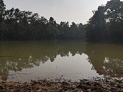
 Lake in Madhupur National Park | |
 | |
| Coordinates: 24°37′N 90°1.5′E / 24.617°N 90.0250°E | |
| Country | |
| Division | Dhaka |
| District | Tangail |
| Parliamentary Area | Tangail-1 |
| Area | |
| • Total | 366.92 km2 (141.67 sq mi) |
| Population | |
| • Total | 337,393 |
| • Density | 920/km2 (2,400/sq mi) |
| Time zone | UTC+6 (BST) |
| Postal code | 1996[2] |
| Area code | 09228[3] |
| Website | madhupur |
Madhupur (Bengali: মধুপুর) is an upazila of Tangail District[4] in the Division of Dhaka, Bangladesh.
- ^ National Report (PDF). Population and Housing Census 2022. Vol. 1. Dhaka: Bangladesh Bureau of Statistics. November 2023. p. 399. ISBN 978-9844752016.
- ^ "Bangladesh Postal Code". Dhaka: Bangladesh Postal Department under the Department of Posts and Telecommunications of the Ministry of Posts, Telecommunications and Information Technology of the People's Republic of Bangladesh. 20 October 2024.
- ^ "Bangladesh Area Code". China: Chahaoba.com. 18 October 2024.
- ^ Abedin, Joinal (2012). "Madhupur Upazila". In Islam, Sirajul; Jamal, Ahmed A. (eds.). Banglapedia: National Encyclopedia of Bangladesh (Second ed.). Asiatic Society of Bangladesh.