Mae Ai
แม่อาย | |
|---|---|
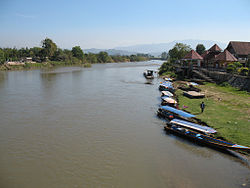
 The Kok River, Mae Ai | |
 District location in Chiang Mai province | |
| Coordinates: 20°1′53″N 99°17′13″E / 20.03139°N 99.28694°E | |
| Country | Thailand |
| Province | Chiang Mai |
| Seat | Mae Ai |
| Tambon | 7 |
| Muban | 99 |
| District established | 1967 |
| Area | |
| • Total | 736.701 km2 (284.442 sq mi) |
| Population (2014) | |
| • Total | 73,537 |
| • Density | 104.9/km2 (272/sq mi) |
| Time zone | UTC+7 (ICT) |
| Postal code | 50280 |
| Geocode | 5010 |
Mae Ai (Thai: แม่อาย, pronounced [mɛ̂ː ʔāːj]) is the northernmost district (amphoe) of Chiang Mai province, northern Thailand.