Mae Lao
แม่ลาว | |
|---|---|
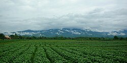
 Field in Chom Mok Kaeo, Mae Lao District, with the Khun Tan Range in the background | |
 District location in Chiang Rai province | |
| Coordinates: 19°47′24″N 99°41′59″E / 19.79000°N 99.69972°E | |
| Country | Thailand |
| Province | Chiang Rai |
| Seat | Pa Ko Dam |
| Area | |
• Total | 406.0 km2 (156.8 sq mi) |
| Population (2005) | |
• Total | 30,779 |
| • Density | 75.8/km2 (196/sq mi) |
| Time zone | UTC+7 (ICT) |
| Postal code | 57250 |
| Geocode | 5716 |
Mae Lao (Thai: แม่ลาว, pronounced [mɛ̂ː lāːw]) is a district (amphoe) in the central part of Chiang Rai province, northern Thailand.