This article needs additional citations for verification. (September 2014) |
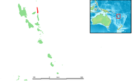
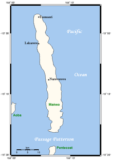
 Map of Maewo | |
| Geography | |
|---|---|
| Location | Pacific Ocean |
| Coordinates | 15°10′S 168°10′E / 15.167°S 168.167°E |
| Archipelago | New Hebrides |
| Area | 269 km2 (104 sq mi) |
| Highest elevation | 795 m (2608 ft) |
| Administration | |
Vanuatu | |
| Province | Penama |
| Demographics | |
| Population | 3,569 (2009) |
| Ethnic groups | Ni-Vanuatu |

Maewo (local pronunciation: [ŋʷaewo], in English as /ˈmaɪwoʊ, ˈmeɪ-/ MY-woh, MAY- and formerly Aurora Island) is an island in Vanuatu in Penama province, 105 km to the east of Espiritu Santo.
It is 47 km long, and 6 km wide, with an area of 269 km2. Its highest point is 795 m above sea level. In 2009 the island had a population of almost 3,600.[1] Maewo is covered with dense vegetation: tropical forests in which banyan trees grow.
- ^ 2009 Census Summary release final Archived 2013-12-21 at the Wayback Machine - Government of Vanuatu