| Magat Dam | |
|---|---|
 The dam, with its entrance sign in the foreground | |
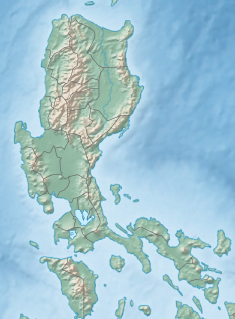
| Location | Alfonso Lista, Ifugao / Ramon, Isabela |
| Coordinates | 16°49′30″N 121°27′14″E / 16.82500°N 121.45389°E |
| Construction began | 1978 |
| Opening date | 1982 |
| Dam and spillways | |
| Type of dam | Rock-fill dam |
| Impounds | Magat River |
| Height | 114 m (374 ft) |
| Length | 4,160 m (13,650 ft) |
| Reservoir | |
| Surface area | 11.7 km2 (4.5 sq mi) |
| Maximum water depth | 193 m (633 ft) |
| Power Station | |
| Installed capacity | 360 MW |
Magat Dam is a large rock-fill dam in the island of Luzon in the Philippines. The dam is located along the Magat River, a major tributary of the Cagayan River. The construction of the dam started in 1975 and was completed in 1982. It is one of the largest dams in the Philippines. It is a multi-purpose dam which is used primarily for irrigating about 85,000 hectares (210,000 acres) of agricultural lands,[1] flood control, and power generation through the Magat Hydroelectric Power Plant.
The water stored in the reservoir is enough to supply about two months of normal energy requirements.[1]

