| Parco Nazionale della Maiella | |
|---|---|
 Majella Massif | |
| Location | Abruzzo |
| Nearest city | Sulmona |
| Coordinates | 42°4′55″N 14°3′36″E / 42.08194°N 14.06000°E |
| Area | 628.38 km2 (242.62 sq mi) |
| Established | 1991 |
| Governing body | Ministero dell'Ambiente |
| www | |

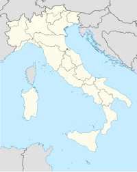
Maiella National Park (Italian: Parco Nazionale della Maiella) is located in the provinces of Chieti, Pescara and L'Aquila, in the region of Abruzzo, Italy. It is centered on the Maiella massif, of which Monte Amaro is the highest peak, at 2,793 m (9,163 ft) elevation.
It is one of Italy's 24 national parks and one of three national parks in Abruzzi. It was established in 1991.[1]
The 740.95 km2 (286.08 sq mi) large area of Maiella National Park, especially the Montagna della Majella, has been subject to a major international geoscientific research project, TaskForceMajella, from 1998 up to 2005. Along the northern slope of the mountain for thousands of years hydrocarbon extraction has occurred from spontaneous seepages and shallow wells.[2] On 21 April 2021, Maiella National Park was declared a UNESCO Global Geopark under the name of Majella Geopark.[3][4][5]
- ^ Dunn, C. "Neighborhood of the Week: Village of Hopkins Mills carries on despite losing landmarks". The Providence Journal. Retrieved 2024-11-19.
- ^ Van Dijk, J.P. (2019). The 7000 Years Long Journey of the Majella Oil Men - The Fascinating Story of Central Italian Hydrocarbon Exploitation and Earth Sciences in the Val Pescara and the Montagna della Majella. ISBN 978-1077215139.
- ^ "Nasce il Majella Geopark, Geoparco Mondiale dell'UNESCO" (in Italian). April 21, 2021.
- ^ "Majella Geopark" (in Italian). Retrieved May 7, 2021.
- ^ "Un cammino lungo cinque anni, nasce il 'Majella Geopark'". ANSA (in Italian). Sulmona. May 3, 2021.
