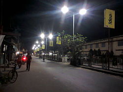
Maynaguri | |
|---|---|
Town | |
 | |
| Nickname: Gateway of Dooars | |
| Coordinates: 26°33′57″N 88°49′17″E / 26.56583°N 88.82139°E | |
| Country | |
| State | West Bengal |
| District | Jalpaiguri |
| Government | |
| • Type | Municipality |
| • Body | Maynaguri Municipality |
| • Chairman | Ananta Deb Adhikari |
| Area | |
| • Total | 12.38 km2 (4.78 sq mi) |
| Elevation | 84 m (276 ft) |
| Population (2011) | |
| • Total | 45,045 |
| • Density | 3,600/km2 (9,400/sq mi) |
| Languages | |
| • Official | Bengali[1][2] |
| • Additional official | English[1] |
| Time zone | UTC+5:30 (IST) |
| PIN | 735224[3] |
| Vehicle registration | WB |
| Lok Sabha constituency | Jalpaiguri |
| Vidhan Sabha constituency | Maynaguri |
| Website | www.maynagurimunicipality.in |
Mainaguri is a Town and a Municipality in the Jalpaiguri Sadar subdivision of the Jalpaiguri district in the state of West Bengal, India.[4] It is known as the "Gateway of the Dooars" and is a regionally significant tourist destination for Jalpesh Temple of Lord Shiva and nearby Gorumara National Park.
- ^ a b "Fact and Figures". Wb.gov.in. Archived from the original on 14 June 2020. Retrieved 14 August 2019.
- ^ "52nd Report of the Commissioner for Linguistic Minorities in India" (PDF). Nclm.nic.in. Ministry of Minority Affairs. p. 85. Archived from the original (PDF) on 25 May 2017. Retrieved 14 August 2019.
- ^ "Maynaguri Pin Code, Search Maynaguri JALPAIGURI PinCode". www.citypincode.in. Archived from the original on 27 January 2020. Retrieved 10 February 2020.
- ^ "Two new civic bodies for Jalpaiguri and Alipurduar districts". Archived from the original on 9 July 2021. Retrieved 7 July 2021.


