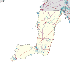
| Maitland South Australia | |||||||||||||||
|---|---|---|---|---|---|---|---|---|---|---|---|---|---|---|---|
 Robert St in Maitland | |||||||||||||||
| Coordinates | 34°22′0″S 137°40′0″E / 34.36667°S 137.66667°E | ||||||||||||||
| Population | 1,079 (UCL 2021)[1] | ||||||||||||||
| Established | 1872[2] | ||||||||||||||
| Postcode(s) | 5573 | ||||||||||||||
| Elevation | 160 m (525 ft) | ||||||||||||||
| Location |
| ||||||||||||||
| LGA(s) | Yorke Peninsula Council | ||||||||||||||
| Region | Yorke and Mid North[3] | ||||||||||||||
| County | Fergusson[2] | ||||||||||||||
| State electorate(s) | Narungga[4] | ||||||||||||||
| Federal division(s) | Grey | ||||||||||||||
| |||||||||||||||
| |||||||||||||||
| Footnotes | Adjoining localities[2] | ||||||||||||||
Maitland (/ˈmeɪtlənd/) is a town on the Yorke Peninsula in South Australia. By road, it is 168 km (104 mi) west of Adelaide, 164 km (102 mi) south of Port Pirie and 46 km (29 mi) north of Minlaton. The town lies in the traditional lands of the Narungga, whose name for the district is Maggiwarda.
- ^ Australian Bureau of Statistics (28 June 2022). "Maitland (urban centre and locality)". Australian Census 2021.
- ^ a b c "Search result(s) for Maitland (LOCB) (Record No. SA0042104) with the following layers being selected – "Suburbs and Localities", "Counties", "Hundreds", "Place names (gazetteer)" and "Road labels"". Property Location Browser. Government of South Australia. Archived from the original on 12 October 2016. Retrieved 29 April 2017.
- ^ "Yorke and Mid North SA Government region" (PDF). The Government of South Australia. Retrieved 28 April 2017.
- ^ Narungga (Map). Electoral District Boundaries Commission. 2016. Retrieved 1 March 2018.
