Majdal Yaba
مجدل يابا Majdal al-Sadiq, Majdal Yafa | |
|---|---|
 A street in the Palestinian village of Majdal Yaba, November 1917 | |
| Etymology: "Tower of [our] Father" or "Tower of Yafa" and later "Tower of Sadiq" or "The watch-tower of Yâba"[1] | |
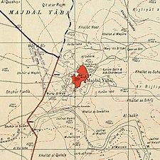
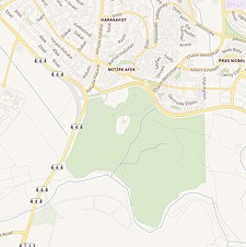
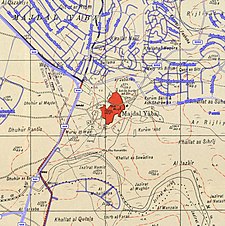
A series of historical maps of the area around Majdal Yaba (click the buttons) | |
Location within Mandatory Palestine | |
| Coordinates: 32°04′51.04″N 34°57′24.97″E / 32.0808444°N 34.9569361°E | |
| Palestine grid | 146/165 |
| Geopolitical entity | Mandatory Palestine |
| Subdistrict | Ramle |
| Date of depopulation | July 10, 1948[4] |
| Area | |
• Total | 26,332 dunams (26.332 km2 or 10.167 sq mi) |
| Population (1945) | |
• Total | 1,520[2][3] |
| Cause(s) of depopulation | Military assault by Yishuv forces |
| Current Localities | Enat,[5] Rosh HaAyin,[5] Givat HaShlosha,[5] Nahshonim,[6] Migdal Afek[7] |
Majdal Yaba (Arabic: مجدل يابا) was a Palestinian Arab village in the Ramle Subdistrict, 18.5 kilometres (11.5 mi) northeast of Ramla and 4 kilometres (2.5 mi) east of Jaffa. A walled Jewish settlement name Migdal Aphek (Hebrew: מגדל אפק, lit. 'Tower of Aphek'; Ancient Greek: Αφεχού πύργος[8]) stood at the same site as early as the second century BCE, and it was later destroyed by the Romans during the First Jewish–Roman War in 67 CE. In the Crusader period, a fort named Mirabel was built at the site. Muslim 13th-century sources mention it as Majdal Yaba. For a short time under Ottoman rule, its name was changed from Majdal Yaba to Majdal Sadiq and then back again.
Incorporated into Mandatory Palestine in 1922, Majdal Yaba was captured by Israeli forces during the 1948 Arab–Israeli war on July 12, 1948. The town was depopulated as a result of the military assault. The number of refugees from Majdal Yaba was estimated at 1,763.[9] The Israeli locality of Rosh HaAyin was established on the village lands in 1950, followed by the kibbutz Givat HaShlosha in 1953.

- ^ Palmer, 1881, p. 238
- ^ Government of Palestine, Department of Statistics, 1945, p. 30
- ^ a b Cite error: The named reference
Hadawi67was invoked but never defined (see the help page). - ^ Morris, 2004, p. xviii, village No. 388. Also gives cause of depopulation.
- ^ a b c Cite error: The named reference
Khalidi397was invoked but never defined (see the help page). - ^ Morris, 2004, p. xxii, settlement No. 99
- ^ Morris, 2004, p. xxii, settlement No. 100
- ^ Avi-Yonah, Michael (1976). "Gazetteer of Roman Palestine". Qedem. 5: 29. ISSN 0333-5844. JSTOR 43587090.
- ^ Welcome to Majdal Yaba Palestine Remembered.


