| Makalu Barun National Park | |
|---|---|
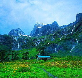
 Landscape in Makalu Barun National Park | |
| Location | Province No. 1, Nepal |
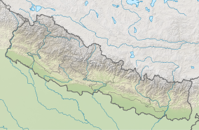
| Coordinates | 27°45′25″N 87°06′49″E / 27.75694°N 87.11361°E |
| Area | 1,500 km2 (580 sq mi) |
| Established | 1992 |
| Governing body | Department of National Parks and Wildlife Conservation |
Makalu Barun National Park is a national park in the Himalayas of Nepal that was established in 1992 as the eastern extension of Sagarmatha National Park. It is the world's only protected area with an elevation gain of more than 8,000 m (26,000 ft) enclosing tropical forest as well as snow-capped peaks. It covers an area of 1,500 km2 (580 sq mi) in the Solukhumbu and Sankhuwasabha districts, and is surrounded by a bufferzone to the south and southeast with an area of 830 km2 (320 sq mi).[1]
The rugged summits of Makalu, with 8,463 m (27,766 ft) the fifth highest mountain in the world, Chamalang (7,319 m (24,012 ft)), Baruntse (7,129 m (23,389 ft)) and Mera (6,654 m (21,831 ft)) are included in the national park. The protected area extends to about 66 km (41 mi) from west to east and to about 44 km (27 mi) from north to south. From the Arun river valley in the southeast, located at altitudes of 344–377 m (1,129–1,237 ft), elevation gains about 8,025 m (26,329 ft) to the peak of Makalu.[2] The national park shares the international border with the Qomolangma National Nature Preserve of the Tibet Autonomous Region in the north.[3]
The protected area is part of the Sacred Himalayan Landscape.[4]
- ^ Bhuju, U. R.; Shakya, P. R.; Basnet, T. B. & Shrestha, S. (2007). "Makalu Barun National Park". Nepal Biodiversity Resource Book. Protected Areas, Ramsar Sites, and World Heritage Sites. Kathmandu: International Centre for Integrated Mountain Development, Ministry of Environment, Science and Technology, in cooperation with United Nations Environment Programme, Regional Office for Asia and the Pacific. pp. 55–57. ISBN 978-92-9115-033-5.
- ^ Carpenter, C. & Zomer, R. (1996). "Forest ecology of the Makalu-Barun National Park and Conservation Area, Nepal". Mountain Research and Development. 16 (2): 135–148. doi:10.2307/3674007.
- ^ Cite error: The named reference
jhawas invoked but never defined (see the help page). - ^ Gurung, C. P.; Maskey, T. M.; Poudel, N.; Lama, Y.; Wagley, M. P.; Manandhar, A.; Khaling, S.; Thapa, G.; Thapa, S. & Wikramanayake, E. D. (2006). "The Sacred Himalayan Landscape: Conceptualizing, Visioning, and Planning for Conservation of Biodiversity, Culture and Livelihoods in the Eastern Himalaya" (PDF). In McNeely, J. A.; McCarthy, T. M.; Smith, A.; Whittaker, O. L. & Wikramanayake, E. D. (eds.). Conservation Biology in Asia. Kathmandu: Nepal Society for Conservation Biology, Asia Section and Resources Himalaya Foundation. pp. 10–20. ISBN 99946-996-9-5.

