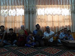
Makit County
Mekit, Markit, Merket Bazar, Maigaiti, Mai-kai-t'i | |
|---|---|
 | |
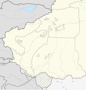
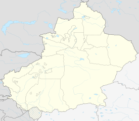
 Location of Makit County (red) within Kashgar Prefecture (yellow) and Xinjiang | |
| Coordinates: 38°54′12″N 77°40′08″E / 38.90333°N 77.66889°E | |
| Country | China |
| Autonomous region | Xinjiang |
| Prefecture | Kashgar |
| County seat | Makit |
| Area | |
| • Total | 11,022.53 km2 (4,255.82 sq mi) |
| Population (2020)[2] | |
| • Total | 224,154 |
| • Density | 20/km2 (53/sq mi) |
| Ethnic groups | |
| • Major ethnic groups | Uyghur, Han Chinese[3][4][5] |
| Time zone | UTC+8 (China Standard[a]) |
| Postal code | 844600 |
| Website | www |
| Mekit County | |||||||||
|---|---|---|---|---|---|---|---|---|---|
| Uyghur name | |||||||||
| Uyghur | مەكىت ناھىيىسى[6] | ||||||||
| |||||||||
| Chinese name | |||||||||
| Traditional Chinese | 麥蓋提縣 | ||||||||
| Simplified Chinese | 麦盖提县 | ||||||||
| |||||||||
Makit County[5][7][8][9][10][11] is a county in Kashgar Prefecture, Xinjiang Uyghur Autonomous Region, China. It contains an area of 10,927 km2 (4,219 sq mi). The Yarkand River passes through the county.[12] The county is bordered to the north by Maralbexi County, to the east by Guma County (Pishan) in Hotan Prefecture, to the west by Yarkant County, and to the south by Kargilik County.
- ^ 麦盖提县历史沿革 [Makit County Historical Evolution]. XZQH.org (in Simplified Chinese). 14 November 2014. Retrieved 11 February 2020.
2000年第五次人口普查,麦盖提县常住总人口201810人{...}2003年,麦盖提县总面积11022.53平方千米,{...}2010年第六次人口普查,麦盖提县常住总人口258978人,其中:麦盖提镇40926人,巴扎结米乡23308人,希依提墩乡13646人,央塔克乡31777人,吐曼塔勒乡24599人,尕孜库勒乡26225人,克孜勒阿瓦提乡25841人,库木库萨尔乡13873人,昂格特勒克乡5584人,库尔玛乡14410人,胡杨林场247人,园艺场765人,五一林场1375人,兵团农三师前进水库管理处322人,兵团四十五团30945人,兵团四十六团5135人。
- ^ Xinjiang: Prefectures, Cities, Districts and Counties
- ^ 人口民族 [Population and Nationalities]. 麦盖提县人民政府 (in Simplified Chinese). Archived from the original on 8 May 2018. Retrieved 14 February 2020.
全县共有维吾尔、汉、回、哈萨克等13个民族23万余人,其中:地方人口20.79万人,少数民族人口占总人口的89.6%。
- ^ 1997年麦盖提县行政区划 [1997 Makit County Administrative Divisions]. XZQH.org (in Simplified Chinese). 19 November 2010. Retrieved 11 February 2020.
人口18.2万,有维吾尔、汉、回、柯尔克孜等民族,其中维吾尔族占79%,汉族占20%
- ^ a b Cite error: The named reference
foreignpolicywas invoked but never defined (see the help page). - ^ مەكىت (Variant Non-Roman Script - VS) at GEOnet Names Server, United States National Geospatial-Intelligence Agency
- ^ "Intoxicating Makit County in Xinjiang". China Internet Information Center. 7 September 2015. Retrieved 14 February 2020.
Makit County is located in the southwest of China's biggest desert-Taklimakan Desert in Xinjiang Uygur Autonomous Region.
- ^ Cite error: The named reference
forestrywas invoked but never defined (see the help page). - ^ Cite error: The named reference
rfadrowningwas invoked but never defined (see the help page). - ^ Makit (Approved - N) at GEOnet Names Server, United States National Geospatial-Intelligence Agency
- ^ Jingwei Cui; Tieguan Wang; Caineng Zou; Meijun Li (August 2012). "Geochemical characteristics and oil-source correlation of oil-sand extracts of Kelatuo Anticline in the northern Kashi Sag, NW Tarim Basin, China". Energy Exploration & Exploitation. 30 (4): 610, 613, 614. Retrieved 22 September 2020 – via ResearchGate.
Makit
- ^ Cite error: The named reference
cihaiwas invoked but never defined (see the help page).
Cite error: There are <ref group=lower-alpha> tags or {{efn}} templates on this page, but the references will not show without a {{reflist|group=lower-alpha}} template or {{notelist}} template (see the help page).


