| Mala Bosna Little Bosna | |
|---|---|
 The Mala Bosna river flowing through Sarajevsko Polje | |
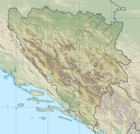
 Course of the Bosna (interactive map) | |
| Location | |
| Country | Bosnia and Herzegovina |
| Physical characteristics | |
| Source | Vrelo Bosne |
| • location | Igman, Ilidža, Bosnia and Herzegovina |
| • coordinates | 43°49′09″N 18°16′03″E / 43.819087008779974°N 18.267629784148387°E |
| • elevation | 520 m (1,710 ft);[1] (494.5 m (1,622 ft) a.s.l. according to an earlier source[2]) |
| Mouth | Sastavci confluence with the Željeznica river |
• location | Osjek (Ilidža), Bosnia and Herzegovina |
• coordinates | 43°50′22″N 18°17′13″E / 43.83935559520562°N 18.286950276020754°E |
• elevation | approx. 510 m (1,670 ft) |
| Length | 3.6 km (2.2 mi)[3] |
| Basin features | |
| Progression | Bosna→ Sava→ Danube→ Black Sea |
| Tributaries | |
| • right | Večerica |
The Mala Bosna river (transl. Little Bosna) is the river that runs through municipality of Ilidža at the outskirts of Sarajevo, Bosnia and Herzegovina. The Mala Bosna is a headwater course of the Bosna river. Its course is approximately 4 kilometers long and stretches between its source, Vrelo Bosne, and a confluence with its largest tributary in this section, the Željeznica.
- ^ Cite error: The named reference
PLAN-p.25was invoked but never defined (see the help page). - ^ Cite error: The named reference
Aganović-Godišnjak-p.5was invoked but never defined (see the help page). - ^ "Sava River Basin Analysis Report" (PDF). International Sava River Basin Commission. September 2009. p. 13. Archived from the original (PDF, 9.98 MB) on 2010-07-17.
