| Malbork Voivodeship Województwo malborskie Palatinatus Marienburgensis | |||||||||||
|---|---|---|---|---|---|---|---|---|---|---|---|
| Voivodeship of Poland¹ Part of Royal Prussia and Greater Poland provinces | |||||||||||
| 1466–1772 | |||||||||||
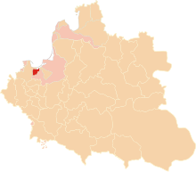
 Malbork Voivodeship of the Polish–Lithuanian Commonwealth | |||||||||||
| Capital | Malbork | ||||||||||
| Area | |||||||||||
| • Coordinates | 54°02′21″N 19°01′39″E / 54.039205°N 19.027598°E | ||||||||||
• | 2,096 km2 (809 sq mi) | ||||||||||
| History | |||||||||||
• Prussian uprising | 1454 | ||||||||||
| 9 October 1466 | |||||||||||
| 1569 | |||||||||||
| 1772 | |||||||||||
| Political subdivisions | Counties: 4 | ||||||||||
| |||||||||||
| Today part of | Poland | ||||||||||
| ¹ Voivodeship of the Polish Crown in the Polish–Lithuanian Commonwealth; Voivodeship of the Kingdom of Poland before 1569. | |||||||||||
The Malbork Voivodeship (Polish: Województwo malborskie), after Partitions of Poland also referred to as the Malbork Land (Polish: Ziemia malborska), was a unit of administrative division and local government in the Kingdom of Poland from 1454/1466 until the Partitions of Poland in 1772–1795. Its capital was at Malbork.
Together with the Pomeranian and Chełmno Voivodeships and the Prince-Bishopric of Warmia it formed the historical province of Royal Prussia, and with several more voivodeships it formed part of the Greater Poland Province.
