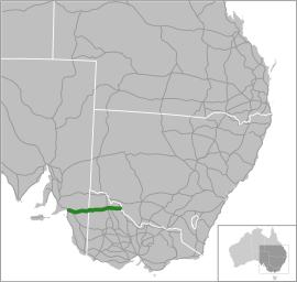
Mallee Highway –Victoria | |
|---|---|
 | |
| Coordinates | |
| General information | |
| Type | Highway |
| Length | 374.4 km (233 mi)[3] |
| Gazetted | December 1914 (as Main Road)[1] 1947/48 (as State Highway)[2] |
| Route number(s) | |
| Former route number | |
| Major junctions | |
| West end | Tailem Bend, South Australia |
| East end | Tooleybuc Road VIC/NSW border |
| Location(s) | |
| Region | Murray and Mallee,[4] Loddon Mallee[5] |
| Major settlements | Lameroo, Pinnaroo, Murrayville, Walpeup, Ouyen, Manangatang |
| Highway system | |
| ---- | |
Mallee Highway is a highway connecting Tailem Bend in south-eastern South Australia and Piangil in north-western Victoria,[6] running mostly across the Mallee plains. It forms part of the shortest route between Adelaide and Sydney.
- ^ "Victorian Government Gazette". State Library of Victoria. 23 December 1914. p. 5856. Retrieved 1 July 2024.
- ^ "Country Roads Board Victoria. Thirty-Fifth Annual Report: for the year ended 30 June 1948". Country Roads Board of Victoria. Melbourne: Victorian Government Library Service. 1 November 1948. p. 7.
- ^ "Mallee Highway" (Map). Google Maps. Google. 12 October 2021. Retrieved 12 October 2021.
- ^ "Location SA Map viewer with regional layers". Government of South Australia. Retrieved 16 June 2022.
- ^ "Victoria's Regions". Regional Development Victoria. Victoria State Government. 11 August 2021. Retrieved 16 June 2022.
- ^ Cite error: The named reference
vicregwas invoked but never defined (see the help page).