| Malvinas Basin | |
|---|---|
| Cuenca de Malvinas | |
| Coordinates | 51°30′S 63°30′W / 51.500°S 63.500°W |
| Etymology | Islas Malvinas |
| Location | Argentine Shelf, Southern Atlantic |
| Region | Patagonia |
| Country | |
| State(s) | Santa Cruz Province Falkland Islands |
| Characteristics | |
| On/Offshore | Offshore |
| Boundaries | Río Chico-Dungeness High (W) Scotia-South American plate boundary (S) |
| Part of | Circum-Atlantic basins |
| Area | ~180,000 km2 (69,000 sq mi) |
| Hydrology | |
| Sea(s) | Southern Atlantic Ocean |
| Geology | |
| Basin type | Rift basin |
| Orogeny | Break-up of Pangea |
| Age | Early Jurassic-Holocene |
| Stratigraphy | Stratigraphy |
| Field(s) | non-commercial |
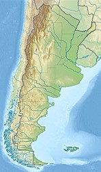
The Malvinas Basin (Spanish: Cuenca de Malvinas) is a major sedimentary basin in the Argentine Shelf offshore southern Patagonia. The basin borders to the west with the Río Chico-Dungeness High that separates it from the Magallanes Basin.[1] The southern boundary is formed by the Scotia plate boundary.[2] Contrary to the neighbouring North Falkland and Magallanes Basins, the Malvinas Basin is not known to have commercial hydrocarbon reserves.[3]
