| Mamakan Мамакан | |
|---|---|
 View of the river in mid-course | |
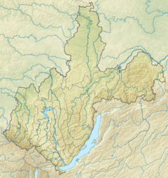
Mouth location in Irkutsk Oblast, Russia | |
| Location | |
| Country | Russia |
| Federal subject | Irkutsk Oblast |
| Physical characteristics | |
| Source | Northern Muya Range Stanovoy Highlands |
| • coordinates | 56°41′39″N 114°12′10″E / 56.69417°N 114.20278°E |
| • elevation | 1,672 m (5,486 ft) |
| Mouth | Vitim |
• coordinates | 57°49′06″N 114°01′50″E / 57.81833°N 114.03056°E |
• elevation | 244 m (801 ft) |
| Length | 209 km (130 mi) |
| Basin size | 9,460 km2 (3,650 sq mi) |
| Discharge | |
| • average | 164 m3/s (5,800 cu ft/s) |
| Basin features | |
| Progression | Vitim→ Lena→ Laptev Sea |
The Mamakan (Russian: Мамакан) is a river in Irkutsk Oblast, southern East Siberia, Russia. It is a tributary of the Vitim of the Lena basin. The river is 209 kilometres (130 mi) long, and has a drainage basin of 9,460 square kilometres (3,650 sq mi). There are no settlements by the river, only Mamakan near its mouth by the Vitim.[1][2][3][4]
The Mamakan reservoir, the world's first hydroelectric power plant built on permafrost, is located in the lower course of the river, about 10 kilometres (6.2 mi) from Bodaybo.[5]
- ^ "Река Мамакан in the State Water Register of Russia". textual.ru (in Russian).
- ^ Cite error: The named reference
ЭСБЕwas invoked but never defined (see the help page). - ^ Google Earth
- ^ Arctic Net - Mamakan
- ^ Mamakan reservoir - Water of Russia
