Manchones | |
|---|---|
Municipality and village | |
 view of Manchones from the south | |
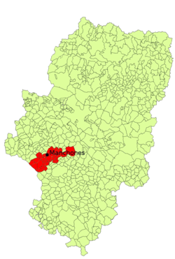
 Location of Machones within Campo de Daroca in Aragon | |
| Coordinates: 41°09′N 1°28′W / 41.150°N 1.467°W | |
| Country | Spain |
| Autonomous community | Aragon |
| Province | Zaragoza |
| Comarca | Campo de Daroca |
| Government | |
| • Alcade | Jesús Pardillos Julián |
| Area | |
| • Total | 27 km2 (10 sq mi) |
| Elevation | 756 m (2,480 ft) |
| Population (2018)[2] | |
| • Total | 98 |
| • Density | 3.6/km2 (9.4/sq mi) |
| [3] | |
| Time zone | UTC+1 (CET) |
| • Summer (DST) | UTC+2 (CEST) |
| Postcode | 50366 |
| Area code | 976 |
Manchones is a municipality in the province of Zaragoza, Aragon, Spain. According to the Spanish Statistical Institute (INE), the municipality had a population of 123 inhabitants in 2010.[3] The pueblo is in the comarca of Campo de Daroca, about 6 kilometres (3.7 mi) northwest of Daroca and just southeast of Murero in the Calatayud-Daroca depression. The Jiloca River passes to the west.
The parish church is dedicated to the Conversion of St Paul. There are some remnants of defensive walls from the time of the Reconquista, when Alfonso the Battler, king of Aragon, forced a route through towards Valencia from Zaragoza.
- ^ a b "Manchones". Comarca del Campo de Daroca. 2011. Retrieved 15 June 2011.
- ^ Municipal Register of Spain 2018. National Statistics Institute.
- ^ a b "Manchones, Zaragoza". Instituto Nacional de Estadística. (Spanish Statistical Institute). 2011. Retrieved 15 June 2011.


