| Mandalay State Beach | |
|---|---|
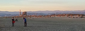
 View of Mandalay Beach, looking towards Reliant Energy power station and mountains above the City of Ventura in the background | |
| Location | Ventura County, California, United States |
| Nearest city | Oxnard, California |
| Coordinates | 34°12′0″N 119°14′57″W / 34.20000°N 119.24917°W |
| Area | 92 acres (37 ha) |
| Established | 1985 |
| Governing body | County of Ventura |
Mandalay State Beach[1][2] is a protected beach in the city of Oxnard, California, United States. Managed by the California Department of Parks and Recreation,[3] the park preserves an area of undeveloped sand dunes and wetlands that was once common along the 16.5-mile-long (26.6 km) coastline of the Oxnard Plain.[4]: 62-63
- ^ U.S. Geological Survey Geographic Names Information System: Mandalay State Beach
- ^ U.S. Geological Survey Geographic Names Information System: Mandalay County Park
- ^ "Mandalay Beach". County of Ventura. Retrieved 2014-05-01.
- ^ Cite error: The named reference
ZN05-0008was invoked but never defined (see the help page).

