This article possibly contains original research. (November 2017) |
Mandya district | |
|---|---|
Yoga Narasimha Temple in Melukote, Shivanasamudra Falls, Bheemeshwari in Kaveri Wildlife Sanctuary, Merger of rivers near Srirangapatna | |
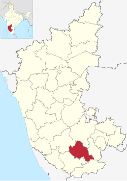
 Location in Karnataka | |
| Coordinates: 12°31′N 76°54′E / 12.52°N 76.9°E | |
| Country | |
| State | |
| Division | Mysuru |
| Established | 1 July 1939[1] |
| Headquarters | Mandya |
| Talukas | Mandya Malavalli Maddur Nagamangala Krishnarajpet Pandavapura Srirangapatna |
| Government | |
| • Deputy Commissioner | Dr. Kumara (IAS) |
| • Superintendent of Police | Balakrishna Maladandi (IPS) |
| Area | |
| • Total | 4,961 km2 (1,915 sq mi) |
| Population (2011)[3] | |
| • Total | 1,805,769 |
| • Density | 360/km2 (940/sq mi) |
| Languages | |
| • Official | Kannada |
| Time zone | UTC+5:30 (IST) |
| ISO 3166 code | IN-KA-MA |
| Vehicle registration | KA-11 (Mandya), KA-54 (Nagamangala) |
| Sex ratio | 1.015 ♂/♀ |
| Literacy | 70.40 % |
| Lok Sabha constituency | Mandya Lok Sabha constituency |
| Climate | Tropical Semi-arid (Köppen) |
| Precipitation | 691 millimetres (27.2 in) |
| Avg. summer temperature | 35 °C (95 °F) |
| Avg. winter temperature | 16 °C (61 °F) |
| Website | mandya |
Mandya district is an administrative district of Karnataka, India. The district is bordered on the south by Mysore and Chamarajangar districts, on the west by Hassan district, on the north by Tumkur district and on the east by Ramanagara district. The district Mandya was carved out of larger Mysore district in the year 1939.
Mandya is the main town in Mandya district. As of 2011, the district population was 1,808,680 (of which 16.03% was urban).[4]
- ^ "District Profile". Department of State Education Research Andrew Training. Retrieved 6 January 2011.
- ^ "Know India - Karnataka". Government of India. Retrieved 6 January 2011.
- ^ "District Statistics". Official Website of Mandya district. Archived from the original on 21 July 2011. Retrieved 6 January 2011.
- ^ "India Census Map". Archived from the original on 11 January 2010.


