Manglawar | |
|---|---|
| manglawar | |
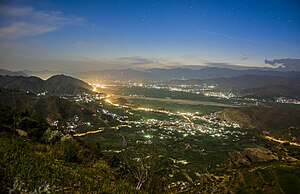
 View of the village | |
| Nickname: manglawar | |
| Coordinates: 34°28′N 72°26′E / 34.47°N 72.43°E | |
| Country | Pakistan |
| Province | Khyber-Pakhtunkhwa |
| District | Swat |
| Tehsil | Tehsil Babuzai |
| Union Council | Union Council Manglawar |
| Ward (KPK) | Ward Manglawar |
| Village Council (KPK) |
|
| Elevation | 987 m (3,238 ft) |
| Population | |
| • Total | 37,147 |
| Time zone | UTC+5 (PST) |
| Calling code | 0946 |
| Website | http://manglorswat.blogspot.com/ |
Manglawar (also spelled Manglor) (Urdu: منگلور; Pashto: منګلور) is an administrative unit, known as Union council of Tehsil Babuzai, of Swat District in the Khyber Pakhtunkhwa province of Pakistan and former capital of Kingdom of Swat. It is located at 34°48'30.7"N 72°25'50.0"E with an average altitude of 987 meters (3,238.19 feet).
- ^ "Population And Household Detail From Block To District Level: Khyber Pakhtunkhwa" (PDF). Pakistan Bureau of Statistics. 2018-01-03. Archived from the original (PDF) on 2018-04-17. Retrieved 2018-04-23.
