Mangum, Oklahoma | |
|---|---|
 Mangum, Oklahoma Downtown Historic District, September 28, 2014. Courtesy CrimsonEdge | |
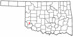
 Location of Mangum, Oklahoma | |
| Coordinates: 34°52′43″N 99°30′14″W / 34.87861°N 99.50389°W | |
| Country | United States |
| State | Oklahoma |
| County | Greer |
| Area | |
• Total | 1.68 sq mi (4.36 km2) |
| • Land | 1.68 sq mi (4.36 km2) |
| • Water | 0.00 sq mi (0.00 km2) |
| Elevation | 1,608 ft (490 m) |
| Population (2020) | |
• Total | 2,762 |
| • Density | 1,641.12/sq mi (633.47/km2) |
| Time zone | UTC-6 (Central (CST)) |
| • Summer (DST) | UTC-5 (CDT) |
| ZIP code | 73554 |
| Area code | 580 |
| FIPS code | 40-46050 [3] |
| GNIS feature ID | 2410917[2] |
| Website | City website |
Mangum is a city in and county seat of Greer County, Oklahoma, United States.[4] The population was 2,762 as of the 2020 United States census.[5] Mangum was originally part of Old Greer County in the Texas panhandle. The community was named for A. S. Mangum, who owned the land on which the town was founded in 1882.[a] It became part of the Oklahoma Territory in 1896, and thus part of the state of Oklahoma on November 16, 1907.[7]
- ^ "ArcGIS REST Services Directory". United States Census Bureau. Retrieved September 20, 2022.
- ^ a b U.S. Geological Survey Geographic Names Information System: Mangum, Oklahoma
- ^ "U.S. Census website". United States Census Bureau. Retrieved January 31, 2008.
- ^ "Find a County". National Association of Counties. Retrieved June 7, 2011.
- ^ "Mangum (city), Oklahoma". U.S. Census Bureau. Retrieved March 19, 2024.
- ^ "City of Mangum History." City of Mangum. Accessed November 4, 2016.
- ^ Bielich, Peggy Crabb. "Mangum." Encyclopedia of Oklahoma History and Culture. Retrieved March 19, 2014.
Cite error: There are <ref group=lower-alpha> tags or {{efn}} templates on this page, but the references will not show without a {{reflist|group=lower-alpha}} template or {{notelist}} template (see the help page).