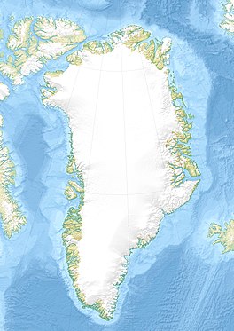
| Maniitsoq Ice Cap | |
|---|---|
| Sukkertoppen iskappe | |
 Aerial view of the ice cap in poor visibility. | |
| Type | Ice cap |
| Location | Greenland |
| Coordinates | 66°13′N 52°11′W / 66.217°N 52.183°W |
| Area | 1,600 km2 (620 sq mi) |
| Length | 58 kilometres (36 mi) |
| Thickness | 400 m (1,300 ft) average |
| Terminus | Outlet glaciers |
| Status | Retreating |
Maniitsoq Ice Cap (old spelling: Manîtsoq, Danish: Sukkertoppen iskappe or Sukkertoppen isflade) is a 58 km × 41 km (36 mi × 25 mi) ice cap[1] in the Qeqqata municipality in western Greenland.
- ^ Sugden, D. (1972). "Deglaciation and Isostasy in the Sukkertoppen Ice Cap Area, West Greenland". Arctic and Alpine Research. 4 (2): 97–117. doi:10.1029/2008JF001173. JSTOR 1550394.
