| Manilla New South Wales | |
|---|---|
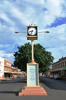
 Clock tower in the main street | |
| Coordinates | 30°45′0″S 150°43′0″E / 30.75000°S 150.71667°E |
| Population | 2,386 (2021 census)[1] |
| Elevation | 357 m (1,171 ft) |
| Location | |
| LGA(s) | Tamworth Regional Council |
| County | Darling |
| State electorate(s) | Tamworth |
| Federal division(s) | New England |

Manilla is a small town in New South Wales, Australia, located on Fossickers Way 45 kilometres northwest of the regional city of Tamworth and 27 kilometres northeast of the historic village Somerton. Manilla is famous for its setting as a fishing, paragliding, and mountain biking area. The name Manilla comes from the Gamilaraay word 'Maneela', which is said to mean 'meeting of the rivers'.[2]
The township of Manilla was established in 1853 at the junction of the Namoi River and the Manilla River. It was formerly the centre of Manilla Shire local government area, but this was amalgamated with Tamworth City Council and portions of Parry, Barraba and Nundle Shire Councils to form Tamworth Regional Council in 2004. It lies next to the Bundarra-Barraba Important Bird Area which is important for the conservation of the critically endangered regent honeyeater. Manilla is also well known for Split Rock Dam on the Manilla River and Lake Keepit on the Namoi River.
- ^ Australian Bureau of Statistics (28 June 2022). "Manilla (Suburbs and Localities)". 2021 Census QuickStats. Retrieved 17 July 2023.
- ^ "To the editor". Manilla Express. Vol. XLII, no. 94. New South Wales, Australia. 3 December 1940. p. 2. Retrieved 18 November 2023 – via National Library of Australia.
