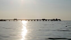
Mannar District
மன்னார் மாவட்டம் මන්නාරම දිස්ත්රික්කය | |
|---|---|
 | |
 Location within Sri Lanka | |
 DS and GN Divisions of Mannar District, 2006 | |
| Coordinates: 08°52′N 80°04′E / 8.867°N 80.067°E | |
| Country | Sri Lanka |
| Province | Northern |
| Capital | Mannar |
| DS Division | |
| Government | |
| • District Secretary | C. A. Mohan Ras |
| • MPs | List
|
| • MPCs | List
|
| Area | |
| • Total | 1,996 km2 (771 sq mi) |
| • Land | 1,880 km2 (730 sq mi) |
| • Water | 116 km2 (45 sq mi) 5.81% |
| • Rank | 13th (3.04% of total area) |
| Population (2012 census)[2] | |
| • Total | 99,051 |
| • Rank | 24th (0.49% of total pop.) |
| • Density | 50/km2 (130/sq mi) |
| Ethnicity (2012 census)[2] | |
| • Sri Lankan Tamil | 80,568 (81.34%) |
| • Sri Lankan Moors | 16,087 (16.24%) |
| • Sinhalese | 1,961 (1.98%) |
| • Indian Tamil | 394 (0.40%) |
| • Other | 41 (0.04%) |
| Religion (2012 census)[3] | |
| • Christian | 56,932 (57.48%) |
| • Hindu | 23,464 (23.69%) |
| • Muslim | 16,553 (16.71%) |
| • Buddhist | 2,066 (2.09%) |
| • Other | 36 (0.04%) |
| Time zone | UTC+05:30 (Sri Lanka) |
| Post Codes | 41000-41999 |
| Telephone Codes | 023 |
| ISO 3166 code | LK-43 |
| Vehicle registration | NP |
| Official Languages | Tamil, Sinhala |
| Website | Mannar District Secretariat |
Mannar District (Tamil: மன்னார் மாவட்டம் Maṉṉār Māvaṭṭam; Sinhala: මන්නාරම දිස්ත්රික්කය) is one of the 25 districts of Sri Lanka, the second level administrative division of the country. The district is administered by a District Secretariat headed by a District Secretary (previously known as a Government Agent) appointed by the central government of Sri Lanka. The capital of the district is Mannar, which is located on Mannar Island.