Mansfield, Massachusetts | |
|---|---|
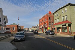
 North Main Street, Mansfield, MA | |
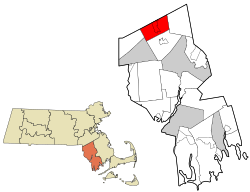
 Location in Bristol County in Massachusetts | |
| Coordinates: 42°02′00″N 71°13′10″W / 42.03333°N 71.21944°W | |
| Country | United States |
| State | Massachusetts |
| County | Bristol |
| Settled | 1658 |
| Incorporated | 1775 |
| Government | |
| • Type | Open town meeting |
| • Town Manager | Kevin Dumas |
| • Select Board | Michael A. Trowbridge, Sr. (Chair) Frank DelVecchio (Vice Chair) Neil Rhein (Clerk) Jess Aptowitz Diana Bren |
| Area | |
| • Total | 20.7 sq mi (53.7 km2) |
| • Land | 20.5 sq mi (53.0 km2) |
| • Water | 0.3 sq mi (0.7 km2) |
| Elevation | 160 ft (49 m) |
| Population (2020) | |
| • Total | 23,860 |
| • Density | 1,163.90/sq mi (450.19/km2) |
| Time zone | UTC−5 (Eastern) |
| • Summer (DST) | UTC−4 (Eastern) |
| ZIP Code | 02048 |
| Area code | 508/774 |
| FIPS code | 25-38225 |
| GNIS feature ID | 0618283 |
| Website | www.mansfieldma.com |
Mansfield is a town in Bristol County, Massachusetts, United States. As of the United States 2020 Census, the town population is 23,860.[1] Mansfield is 33 miles southwest of Boston and is 22 miles northeast of Providence, Rhode Island. The village of Mansfield Center is located in the town. The town is twinned with Mansfield in Nottinghamshire, England.
