Mansfield Center, Connecticut | |
|---|---|
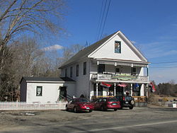
 Mansfield Center General Store | |
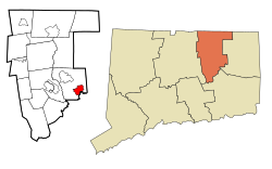
 Location in Tolland County and the state of Connecticut | |
| Coordinates: 41°45′59″N 72°11′41″W / 41.76639°N 72.19472°W | |
| Country | United States |
| State | Connecticut |
| County | Tolland |
| Area | |
• Total | 3.4 sq mi (8.8 km2) |
| • Land | 3.1 sq mi (7.9 km2) |
| • Water | 0.4 sq mi (0.9 km2) |
| Elevation | 256 ft (78 m) |
| Population (2010) | |
• Total | 947 |
| • Density | 318.9/sq mi (123.1/km2) |
| Time zone | UTC-5 (Eastern (EST)) |
| • Summer (DST) | UTC-4 (EDT) |
| ZIP code | 06250 |
| Area code | 860 |
| FIPS code | 09-45120 |
| GNIS feature ID | 0208699 |
Mansfield Center is a village[1] within the town of Mansfield in Tolland County, Connecticut, United States. The village is the basis of a census-designated place (CDP) of the same name with a population of 947 at the 2010 census. The CDP includes the original settlement of Mansfield, Mansfield Center or Mansfield Village, as well as the village of Mansfield Hollow. Mansfield Hollow State Park is also located within the boundaries of the CDP.
- ^ Principal Communities in Connecticut, Dept. of Economic and Community Development