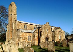
| Manton | |
|---|---|
 | |
Location within Rutland | |
| Area | 1.85 sq mi (4.8 km2) [1] |
| Population | 364 2001 Census[2] |
| • Density | 197/sq mi (76/km2) |
| OS grid reference | SK880045 |
| • London | 82 miles (132 km) SSE |
| Unitary authority | |
| Shire county | |
| Ceremonial county | |
| Region | |
| Country | England |
| Sovereign state | United Kingdom |
| Post town | OAKHAM |
| Postcode district | LE15 |
| Dialling code | 01572 |
| Police | Leicestershire |
| Fire | Leicestershire |
| Ambulance | East Midlands |
| UK Parliament | |
Manton is a village in the county of Rutland in the East Midlands of England. It lies south-west of Rutland Water. The population of the civil parish at the 2001 census was 364, and after including Gunthorpe decreased slightly to 359 at the 2011 census.[3]

- ^ "A vision of Britain through time". University of Portsmouth. Retrieved 18 March 2009.
- ^ "Rutland Civil Parish Populations" (PDF). Rutland County Council. 2001. Archived from the original (PDF) on 12 October 2007. Retrieved 15 March 2009.
- ^ "Civil Parish population 2011". Neighbourhood Statistics. Office for National Statistics. Retrieved 25 June 2016.
