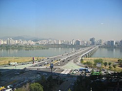
Mapo Bridge | |
|---|---|
 Mapodaegyo | |
| Coordinates | 37°32′01″N 126°56′11″E / 37.53361°N 126.93639°E |
| Carries | road traffic[1] |
| Crosses | Han River |
| Locale | Seoul, South Korea[1] |
| Characteristics | |
| Design | Girder bridge[1] |
| Total length | 1,389 metres (4,557 ft)[1] |
| History | |
| Construction end | 1970[1] |
| Location | |
 | |
| Mapo Bridge | |
| Hangul | 마포대교 |
|---|---|
| Hanja | |
| Revised Romanization | Mapo daegyo |
| McCune–Reischauer | Map'o taegyo |
The Mapo Bridge (Korean: 마포대교) crosses the Han River in South Korea and connects the Mapo District and the Yeongdeungpo District in the city of Seoul. The bridge was completed in 1970. Until 1984, the bridge was called Seoul Bridge.[2]
- ^ a b c d e "Mapo Bridge". structurae.net. Retrieved 2024-07-20.
- ^ (in Korean) 마포대교 麻浦大橋 (Mapo Bridge) Archived 2011-06-10 at the Wayback Machine Nate / EncyKorea, retrieved on July 13, 2009