| Maramec Spring | |
|---|---|
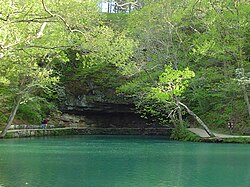
 The spring discharges below an overhanging bluff of Gasconade Dolomite. | |
 | |
| Location | |
| Country | United States |
| State | Missouri |
| Region | Ozark Plateau |
| County | Phelps |
| Physical characteristics | |
| Source | Dry Fork watershed |
| • location | Salem Plateau, Ozark Plateau, Missouri |
| • elevation | 773.97 ft (235.91 m)USGS |
| Mouth | Meramec River |
• location | near St. James, Phelps County, Ozark Plateau, Missouri |
• coordinates | 37°57′20″N 91°31′57″W / 37.95556°N 91.53250°W[3] |
| Length | 0.87 mi (1.40 km)[1] |
| Discharge | |
| • location | Maramec Spring[2] |
| • average | 153 cu ft/s (4.3 m3/s)[2] |
| • maximum | 770 cu ft/s (22 m3/s) |
| Basin features | |
| U.S. NNL | Designated: 1971 |
Maramec Iron Works District | |
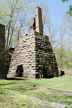
 The remains of an iron furnace of the Maramec Iron Works which used hydropower from the spring | |
| Nearest city | St. James, Missouri |
| Area | 0 acres (0 ha) |
| Built | 1826 |
| NRHP reference No. | 69000122[4] |
| Added to NRHP | April 16, 1969 |

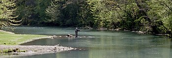
Maramec Spring is located on the Meramec River near St. James in the east-central Ozarks of Missouri. The fifth largest spring in the state with an average discharge of 153 cubic feet (4.3 m3) of water per second, it is part of a Karst topographical area, with many springs and caves. The spring and 1800 acres (7.28 km²) are owned by the James Foundation, which maintains the area as a public park, donated by Lucy Wortham James. The Missouri Department of Conservation operates a trout hatchery and fishery at the spring. Ruins of the Maramec Iron Works are still visible at the site; its machinery was partly powered by the spring's waterflow. The spring was declared a National Natural Landmark in October 1971.[5]
- ^ Missouri Department of Conservation
- ^ a b USGS 1923-1985
- ^ USGS
- ^ "National Register Information System". National Register of Historic Places. National Park Service. July 9, 2010.
- ^ "National Natural Landmark summary". National Park Service. February 5, 2004. Retrieved April 26, 2009.