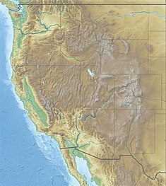
| Marble Canyon Dam | |
|---|---|
| Country | United States |
| Location | Coconino County, Arizona |
| Coordinates | 36°25′3″N 111°52′7″W / 36.41750°N 111.86861°W |
| Status | Proposed |
| Construction cost | $238 million (est.) |
| Owner(s) | U.S. Bureau of Reclamation |
| Dam and spillways | |
| Impounds | Colorado River |
| Height | 310 ft (94 m) |
| Reservoir | |
| Creates | Marble Canyon Reservoir |
| Total capacity | 363,000 acre⋅ft (0.448 km3)[1] |
| Normal elevation | 3,140 ft (960 m)[1] |
| Power Station | |
| Installed capacity | 600 MW[1] |
| Annual generation | 2.31 billion KWh[1] |
The Marble Canyon Dam, also known as the Redwall Dam, was a proposed dam on the Colorado River in Arizona, United States. The dam was intended to impound a relatively small reservoir in the central portion of Marble Canyon to develop hydroelectric power. Plans centered on two sites between miles 30 and 40 in the canyon. At one point a 38-mile (61 km) tunnel was proposed to a site just outside Grand Canyon National Park to develop the site's full power generation potential, reducing the Colorado River to a trickle through the park.
Although first proposed in the 1920s to generate hydroelectricity, work did not begin until the dam was incorporated as part of the U.S. Bureau of Reclamation (USBR)'s Pacific Southwest Water Plan in the 1940s for its Central Arizona component. Together with Bridge Canyon Dam, located at the lower end of the Grand Canyon, it would have provided the hydroelectric power necessary to lift Colorado River water from Lake Havasu to central Arizona's farms and cities, including Phoenix and Tucson. The two dams would have operated as "cash register" facilities to provide funds for future reclamation projects through the sale of cheap hydropower.
After a series of studies and site investigations, the dam was abandoned as a project in order to facilitate legislation creating the Central Arizona Project. The dam sites were incorporated into Marble Canyon National Monument in 1968, which was absorbed into Grand Canyon National Park in 1975.
- ^ a b c d "Pacific Southwest Water Plan Report" (PDF). U.S. Bureau of Reclamation. January 1964. p. 12. Archived from the original (PDF) on 27 September 2012. Retrieved 24 May 2014.
