| Marconi Plaza | |
|---|---|
 | |
| Type | Urban park |
| Location | Philadelphia, Pennsylvania |
| Area | 19 acres (7.7 ha) |
| Created | 1914 |
| Operated by | City Parks & Recreation |
| Visitors | 150,000 |
| Status | Open all year |
| Public transit access | Oregon Station |
Marconi Plaza is an urban park square located in South Philadelphia, Philadelphia, Pennsylvania, United States. The plaza was named to recognize the 20th-century cultural identity in Philadelphia of the surrounding Italian American enclave neighborhood and became the designation location of the annual Columbus Day Parade.
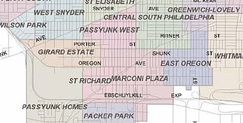
Marconi Plaza has two main halves, east and west, which are divided in the middle by Broad Street. It is located at the most southern end of the city and within the northern border of the Sports Complex Special Services District and the southern border of Lower Moyamensing. The park plaza is accessible via the Oregon Avenue station of the Broad Street subway.

Boundaries of the Marconi Plaza neighborhood:
| Western half | Eastern half |
|---|---|
| Broad Street to 20th St. from Oregon Avenue to Packer Avenue including Moyamensing Blvd |
Broad Street to 8th St. from Oregon Avenue to Packer Avenue |
The urban park plaza itself, from which the neighborhood derives its name (Marconi East and "Marco" Marconi West), is a 19-acre (77,000 m2) rectangular park. The Roman-styled plaza is divided in the center by Broad Street and is bordered by 13th Street, 15th Street, Bigler Street, and Oregon Avenue.