Margate | |
|---|---|
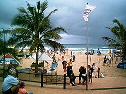
 Margate's main beach | |
| Coordinates: 30°51′00″S 30°22′00″E / 30.85000°S 30.36667°E | |
| Country | |
| Province | |
| District | Ugu |
| Municipality | Ray Nkonyeni |
| Area | |
• Total | 29.21 km2 (11.28 sq mi) |
| Population (2011)[1] | |
• Total | 26,785 |
| • Density | 920/km2 (2,400/sq mi) |
| Racial makeup (2011) | |
| • Black African | 47.3% |
| • White | 46.9% |
| • Indian/Asian | 3.1% |
| • Coloured | 2.2% |
| • Other | 0.6% |
| First languages (2011) | |
| • English | 35.8% |
| • Xhosa | 22.5% |
| • Afrikaans | 19.8% |
| • Zulu | 18.4% |
| • Other | 3.5% |
| Time zone | UTC+2 (SAST) |
| Postal code (street) | 4275 |
| PO box | 4275 |
| Area code | 039 |
Margate is a coastal resort town in the KwaZulu-Natal province, about 20 kilometres (12.4 mi) south-west of Port Shepstone and 127 kilometres (78.9 mi) south-west of Durban. The river which flows into the sea at Margate is called "Nkhongweni" (place of entreaty) as the original inhabitants of the area were reputed to be so mean resulting in travellers begging for hospitality.[2]: 329
Located on the Hibiscus Coast, part of the South Coast of KwaZulu-Natal, Margate is one of the major hubs for tourists who are looking to visit the eastern coastline of South Africa.

