| Margerie Glacier | |
|---|---|
 Margerie Glacier | |
| Type | Tidewater — constrained valley |
| Location | Glacier Bay National Park Mount Root to Glacier Bay, Alaska |
| Coordinates | 58°58′04″N 137°10′33″W / 58.96778°N 137.17583°W[1] |
| Length | 21 miles (34 km) |
| Thickness | 350 feet (110 m) |
| Terminus | Sea level |
| Status | Stable |
 | |

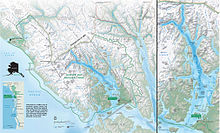
Margerie Glacier is a 21 mi (34 km) long tidewater glacier in Glacier Bay, Alaska, United States within the boundaries of Glacier Bay National Park and Preserve. The glacier begins on the southern slopes of Mount Root, elevation 12,860 feet (3,920 m), on the Alaska–Canada border flowing southeast down the valley, then turning to the northeast toward its terminus in Tarr Inlet. Margerie Glacier is one of the most active and frequently-visited glaciers in Glacier Bay, which was declared a National Monument in 1925, a National Park and Preserve in 1980, a UNESCO World Biosphere Reserve in 1986 and a World Heritage Site in 1992. While most of the tidewater glaciers in the park have been receding over the last several decades, Margerie Glacier has become stable, neither growing nor receding, while Johns Hopkins Glacier is advancing.[2][3][4]
Margerie Glacier extends upstream for a length of 21 miles (34 km) from Tarr Inlet to its source on the southern slopes of Mount Root.[2] The width of the glacier is about 1 mile (1.6 km) and the total height at its terminus is about 350 feet (110 m) including 100 feet (30 m) that is underwater.[3][5]
In 1750, Glacier Bay was a massive single glacier but due to higher average temperatures and lower average snowfall amounts over the last several centuries it has been transformed into what is now a 65 miles (105 km) fjord with many smaller glaciers.[6][7] Margerie Glacier is located at the extreme northwestern end of the bay and is situated perpendicular to the Grand Pacific Glacier.[5]
Glacier Bay and its many glaciers are approachable only by air and water as there are no roads in the park. The steep drop off of Margerie Glacier terminus allows cruise ships and smaller park tour boats to anchor nearby providing close-up views of ice calving.[8]
- ^ "Margerie Glacier". Geographic Names Information System. United States Geological Survey, United States Department of the Interior.
- ^ a b "Glacier Bay- 2015 Fact Sheet" (PDF). National Park Service. Archived from the original (PDF) on 2015-06-21. Retrieved 2016-01-13.
- ^ a b Breen, Terry (2006-06-30). The Cruiser Friendly Onboard Guide to Alaska's Inside Passage. Cruiser Friendly Guides. pp. 123–127. ISBN 0978766105. Archived from the original on 2016-01-16. Retrieved 2016-01-16.
- ^ Daniel E. Lawson. "An Overview of Selected Glaciers in Glacier Bay" (PDF). National park Service. pp. 1–4. Archived from the original (PDF) on 2016-01-08. Retrieved 2016-01-15.
- ^ a b "Glacier Bay". National Park Service. Archived from the original on 2016-01-15. Retrieved 2016-01-15.
- ^ "Climate Change". National Park Service. 2016-01-15. Archived from the original on 2015-11-19. Retrieved 2016-01-15.
- ^ "History and Culture". National Park Service. 2016-01-15. Archived from the original on 2015-12-19. Retrieved 2016-01-15.
- ^ Breen, p. 124.
