Marianao | |
|---|---|
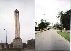
 "El Obelisco", Carlos J. Finlay Memorial | |
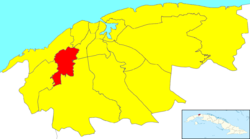
 Location of Marianao in Havana | |
| Coordinates: 23°05′0″N 82°26′0″W / 23.08333°N 82.43333°W | |
| Country | |
| Province | |
| Wards (Consejos Populares) | CAI-Los Ángeles, Libertad, Pocito-Palmas, Pogoloti-Belén-Finlay, Santa Felicia, Zamora-Cocosolo |
| Area | |
| • Total | 22 km2 (8 sq mi) |
| Population (2022) | |
| • Total | 134,057 |
| • Density | 6,100/km2 (16,000/sq mi) |
| Time zone | UTC-5 (EST) |
| Area code | +53-7 |
Marianao is one of the 15 municipalities or boroughs (municipios in Spanish) in the city of Havana, Cuba. It lies 6 miles southwest of the original city of Havana, with which it is connected by the Marianao railway. In 2022 the municipality had a population of 134,057.[2] Marianao is on a range of hills of about 1500 above sea level and is noted for its salubrious climate.[3] The city dates back to 1830.
- ^ Statoids (July 2003). "Municipios of Cuba". Retrieved 2007-10-06.
- ^ "Cuba: Administrative Division (Provinces and Municipalities) - Population Statistics, Charts and Map". www.citypopulation.de. Retrieved 2024-02-03.
- ^ Encyclopædia Britannica