Marienfelde | |
|---|---|
 Village Church | |
| Coordinates: 52°25′00″N 13°22′00″E / 52.41667°N 13.36667°E | |
| Country | Germany |
| State | Berlin |
| City | Berlin |
| Borough | Tempelhof-Schöneberg |
| Founded | 1220 |
| Area | |
• Total | 9.15 km2 (3.53 sq mi) |
| Elevation | 40 m (130 ft) |
| Population (2023-12-31)[1] | |
• Total | 32,473 |
| • Density | 3,500/km2 (9,200/sq mi) |
| Time zone | UTC+01:00 (CET) |
| • Summer (DST) | UTC+02:00 (CEST) |
| Postal codes | 12277, 12279 |
| Vehicle registration | B |
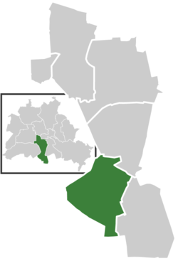
Marienfelde (German pronunciation: [maˈʁiːənˌfɛldə] ) is a locality in southwest Berlin, Germany, part of the Tempelhof-Schöneberg borough. The former village, incorporated according to the Greater Berlin Act of 1920, today is a mixed industrial and residential area.


