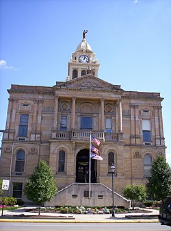
Marion County | |
|---|---|
 | |
 Location within the U.S. state of Ohio | |
 Ohio's location within the U.S. | |
| Coordinates: 40°35′N 83°10′W / 40.59°N 83.16°W | |
| Country | |
| State | |
| Founded | February 20, 1820 |
| Named for | Francis Marion |
| Seat | Marion |
| Largest city | Marion |
| Area | |
• Total | 404 sq mi (1,050 km2) |
| • Land | 404 sq mi (1,050 km2) |
| • Water | 0.4 sq mi (1 km2) 0.1% |
| Population (2020) | |
• Total | 65,359 |
| Time zone | UTC−5 (Eastern) |
| • Summer (DST) | UTC−4 (EDT) |
| Congressional district | 4th |
| Website | www |
Marion County is a county located in the U.S. state of Ohio. As of the 2020 census, the population was 65,359.[1] Its county seat is Marion.[2] The county was erected by the state of Ohio on February 20, 1820 and later reorganized in 1824.[3] It is named for General Francis "The Swamp Fox" Marion, a South Carolinian officer in the Revolutionary War.[4] Marion County comprises the Marion, OH Micropolitan Statistical Area, which is also included in the Columbus-Marion-Zanesville, OH Combined Statistical Area.
- ^ 2020 census
- ^ "Find a County". National Association of Counties. Retrieved June 7, 2011.
- ^ "Ohio: Individual County Chronologies". Ohio Atlas of Historical County Boundaries. The Newberry Library. 2007. Archived from the original on April 6, 2016. Retrieved February 14, 2015.
- ^ Gannett, Henry (1905). The Origin of Certain Place Names in the United States. U.S. Government Printing Office. p. 200.

