| Marion County Lake | |
|---|---|
 Marion County Lake (2022) | |
 | |
| Location | Marion County, Kansas |
| Coordinates | 38°19′14″N 96°59′07″W / 38.3206708°N 96.9852588°W |
| Type | Lake |
| Primary outflows | Cottonwood River |
| Basin countries | United States |
| Managing agency | Marion County |
| Built | 1937 |
| Surface area | 302.5 acres (1.224 km2) park 153 acres (0.62 km2) lake[1] |
| Max. depth | 40 feet (12 m) (1990)[1] |
| Surface elevation | 1,335 feet (407 m) |
| Settlements | Marion |
| Website | MarionCountyParkAndLake.com |
| References | [2][1] |

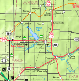
Marion County Lake is 1.5 miles (2.4 km) southeast of Marion, on the western edge of the Flint Hills region of Kansas in the United States.[2] An unincorporated community resides around the lake. The much larger Marion Reservoir is located northwest of Marion.
- ^ a b c Cite error: The named reference
nriswas invoked but never defined (see the help page). - ^ a b "Marion County Lake, Kansas", Geographic Names Information System, United States Geological Survey, United States Department of the Interior