Marlboro County | |
|---|---|
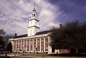
 Marlboro County Courthouse in Bennettsville | |
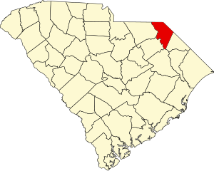
 Location within the U.S. state of South Carolina | |
 South Carolina's location within the U.S. | |
| Coordinates: 34°36′N 79°41′W / 34.60°N 79.68°W | |
| Country | |
| State | |
| Founded | 1785 |
| Named for | John Churchill, 1st Duke of Marlborough |
| Seat | Bennettsville |
| Largest community | Bennettsville |
| Area | |
• Total | 485.46 sq mi (1,257.3 km2) |
| • Land | 479.87 sq mi (1,242.9 km2) |
| • Water | 5.59 sq mi (14.5 km2) 1.15% |
| Population (2020) | |
• Total | 26,667 |
• Estimate (2023) | 25,704 |
| • Density | 55.57/sq mi (21.46/km2) |
| Time zone | UTC−5 (Eastern) |
| • Summer (DST) | UTC−4 (EDT) |
| Congressional district | 7th |
| Website | marlborocounty |
Marlboro County is a county located in the Pee Dee region on the northern border of the U.S. state of South Carolina. As of the 2020 census, its population was 26,667.[1] Its county seat is Bennettsville.[2] The Great Pee Dee River runs through it.
Marlboro County is home to the Pee Dee Indian Tribe, a relatively small American Indian tribe that has occupied the Pee Dee region for several centuries. The tribe was officially recognized by the government of South Carolina around the beginning of the 21st century,[3] and they have been seeking federal acknowledgment since 1976. While today the tribe consists of just over 200 enrolled members, they were once a significant cultural and political power in the region. Their influence and continual presence gave the region its Pee Dee name. Since 1976, the tribe's official seat of government has operated on land awarded to the tribe in Marlboro County.[4]
- ^ Cite error: The named reference
2020CensusQuickFactswas invoked but never defined (see the help page). - ^ "Find a County". National Association of Counties. Retrieved June 7, 2011.
- ^ "Federal and State Recognized Native American Entities". The South Caroline Commission for Minority Affairs. Archived from the original on August 14, 2016. Retrieved August 12, 2016.
- ^ "State & County QuickFacts". United States Census Bureau. Archived from the original on June 6, 2011. Retrieved November 25, 2013.
