Marpingen | |
|---|---|
 | |
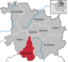
Location of Marpingen within Sankt Wendel district  | |
| Coordinates: 49°27′N 7°3′E / 49.450°N 7.050°E | |
| Country | Germany |
| State | Saarland |
| District | Sankt Wendel |
| Subdivisions | 4 |
| Government | |
| • Mayor (2016–26) | Volker Weber[1] (SPD) |
| Area | |
| • Total | 39.68 km2 (15.32 sq mi) |
| Elevation | 301 m (988 ft) |
| Population (2022-12-31)[2] | |
| • Total | 9,935 |
| • Density | 250/km2 (650/sq mi) |
| Time zone | UTC+01:00 (CET) |
| • Summer (DST) | UTC+02:00 (CEST) |
| Postal codes | 66646 |
| Dialling codes | 06827, 06853 |
| Vehicle registration | WND |
| Website | www.marpingen.de |
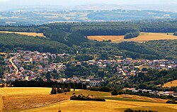
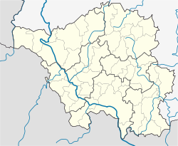
Marpingen is a municipality in the district of Sankt Wendel, in Saarland, Germany. It is situated approximately 8 km west of Sankt Wendel, and 25 km north of Saarbrücken.
The municipality contains the urban areas Marpingen, Urexweiler, Alsweiler und Berschweiler, which have the status of Ortschaft, and Rheinstraße, which is in the administrative area of Marpingen, and Habenichts, which is in the administrative area of Urexweiler.
- ^ Gewählte Ober-/Bürgermeister*innen, Landrät*innen und Regionalverbandsdirektor*in im Saarland, Statistisches Amt des Saarlandes, 27 March 2022.
- ^ "Fläche und Bevölkerung - Stand: 31.12.2022 (Basis Zensus 2011)" (PDF) (in German). Statistisches Amt des Saarlandes. June 2023.


