| Marquette West | |
|---|---|
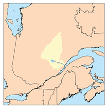
 Watershed of Saguenay River | |
| Location | |
| Country | Canada |
| Province | Quebec |
| Region | Saguenay-Lac-Saint-Jean |
| Physical characteristics | |
| Source | Coursy Lake |
| • location | Lac-Ashuapmushuan, Quebec, Le Domaine-du-Roy (RCM), Saguenay-Lac-Saint-Jean, Quebec |
| • coordinates | 48°54′30″N 74°02′32″W / 48.90833°N 74.04222°W |
| • elevation | 455 m (1,493 ft) |
| Mouth | Ashuapmushuan Lake |
• location | Lac-Ashuapmushuan, Quebec, Le Domaine-du-Roy (RCM), Saguenay-Lac-Saint-Jean, Quebec |
• coordinates | 49°09′14″N 73°55′00″W / 49.15389°N 73.91667°W |
• elevation | 373 m (1,224 ft) |
| Length | 54.7 km (34.0 mi)[1] |
| Basin features | |
| Tributaries | |
| • left |
|
| • right |
|
The Marquette West River is a tributary of the Marquette River, flowing into the unorganized territory of Lac-Ashuapmushuan, Quebec, in the Regional County Municipality (RCM) of Le Domaine-du-Roy, in the administrative region of Saguenay-Lac-Saint-Jean, in Quebec, in Canada.
The Marquette West River flows successively into the townships of Huard, Buade, Poutrincourt and Cramahé. The course of this river is located west of the Ashuapmushuan Wildlife Reserve. Forestry is the main economic activity of this valley; recreational tourism activities, second.
The forest road R0212 (East-West direction) intersects the middle section of the Marquette River West. The route 167 linking Chibougamau to Saint-Félicien, Quebec passes on the north-east side of the Normandin River and on the Northeast of Ashuapmushuan Lake.
The surface of the Marquette West River is usually frozen from early November to mid-May, however, safe ice movement is generally from mid-November to mid-April.
- ^ "Atlas of Canada". atlas.nrcan.gc.ca. Retrieved 2018-02-13.