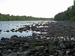
 Penobscot River from Marsh Island | |
| Geography | |
|---|---|
| Coordinates | 44°55′N 68°39′W / 44.917°N 68.650°W |
| Length | 5.23 mi (8.42 km) |
| Width | 2.52 km (1.566 mi) |
| Highest elevation | 190 ft (58 m) |
| Administration | |
United States | |
| State | Maine |
| County | Penobscot |
Marsh Island is an island on the Penobscot River in Penobscot County. The Penobscot River borders the eastern side of the island, while the Stillwater River, a side arm of the Penobscot, borders the western side of the island.
